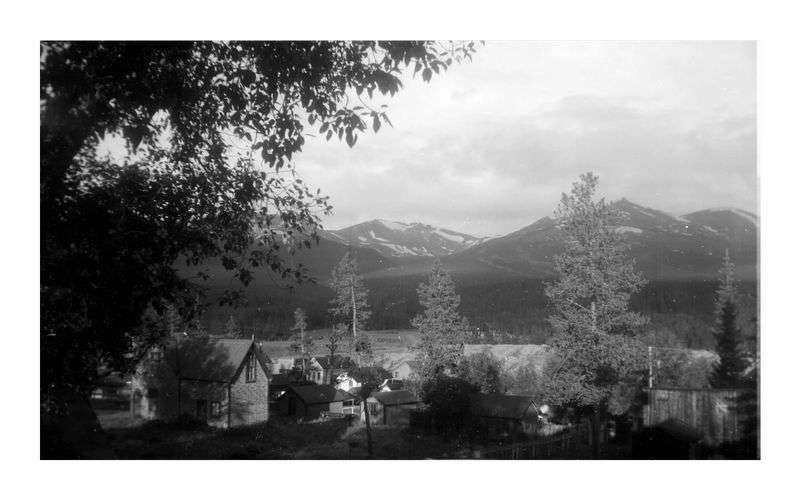
Dyersville, Breckenridge (523 at Wedgewood Lodge)
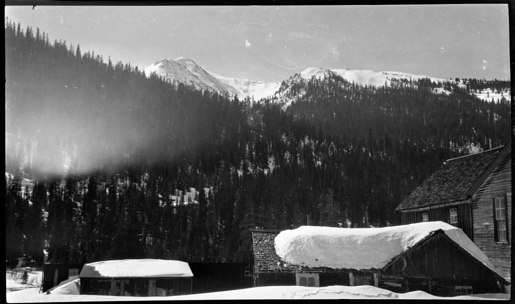
by Julia Anna Moore Hello friend, Welcome to the Wedgewood Lodge, slope-side, next to Snowflake Lift. Snowflake is a one-of-a-kind two-person lift that has a mid-load station and 70-degree turn to put you at Peak 8. It’s personally one of my favorite lifts of all time especially when snow is quietly falling, blanketing the landscape in Colorado’s legendary white powder. We’re extremely stoked that you have chosen Breckenridge, and even more so that you’re staying with us. We pride ourselves in being a long-standing boutique experience, with studio spaces to three bedroom townhomes. We’re still family-owned and operated and specialize in group travel and weddings. Whether you’re here for the ski season or a summer getaway, we are only a few blocks from Main Street and just a stones throw from the slopes where you can ride and hike. We renovated in 2023–2024 and within that renovation we decided to customize each and every space with unique historic photographs curated by me (Jules)! The artwork in your unit is unique to you and contains a piece of Breck’s history. In addition, you’ll see some of my own photographs sprinkled throughout the space. Each unit is also named after a run somewhere in Breck’s 3,000+ acres, with the story behind it explained below. Unfortunately, we only have 52 units, so a lot of runs were left unmentioned but we hope that you get to explore as much as you can. At Wedgewood, we love where we live and want to display how far the town has come. Thanks for coming, and enjoy your stay. How to get to Dyersville. This run is a green run that is easily accessible from the Snowflake Chair that is in our backyard. You can lap this run with your kids, friends, or other family members by riding Rip’s Ride. It’s a great learning area with an easy tree run separating it and Trygve’s Run. This trail was named after a real life town from the mining era located on Boreas Pass, now a ghost town with a few half-standing cabins. Log cabins. Just like in Dyersville, the area where Breckenridge is located was full of log cabins, dotting the landscape. People were hopeful that they would find riches here; some were lucky. You can find ghost towns of these cabins like in St. Elmo, or you can look at the modern cabins today that are inspired by the mountainous style. Left to top to bottom: French Gulch: Dilapidated buildings occupy an area in French Gulch, near Breckenridge (Summit County), Colorado. Original creator: 1942; Wolle, Muriel Sibell, 1898-1977. Denver Public Library Special Collections, X-3182. Snow covered cabin in Breckenridge during the Big Snow of 1899: A cabin is buried under snow during the winter of 1898-1899. Handwritten on the reverse: “cabin in Breckenridge Big snow 1899”. Original creator: 1899 (Creation); Unidentified. Agnes Miner Collection; Gift, Colorado Springs Ghost Town Club. Breckenridge History, Colorado. Two men and a burro with mill or smelter buildings in the background, west of Breckenridge: Two well-dressed men and a burro stand outside a rough hewn log cabin by the Blue River, west of Main Street, Breckenridge, Colorado. Wagons are parked nearby. Looking southwest with Colorado and Southern (C&S) railway boxcars and mill and/or smelter buildings in the background. Original creator: Circa early 1900s; Westerman, Otto. Breckenridge History, Colorado. East face of house at 123 South Ridge Street, Breckenridge: Handwritten on reverse: “Abbett’s, Block 12, Lot 9, Building 97, East face.” Original creator: 28672; Unidentified. Town of Breckenridge Inventory of Historic District Structures, 1975-1980. Breckenridge History, Colorado. Edwin Carter’s log cabin in Breckenridge: Edwin Carter’s log cabin residence and museum in Breckenridge, Colorado. Title quoted from handwritten text on the reverse: “The old Carter museum showing Peak 8 Breckenridge.” Original creator: 1900s (Creation); Westerman, Otto. Agnes Miner Collection; Gift, Colorado Springs Ghost Town Club. Breckenridge History, Colorado Snow covers a wood-frame building, log cabin and outbuildings: Snow covers the roofs of wood-frame building, log cabin and outbuildings. Probably a homestead in Montezuma or Peru Creek area in Summit County, Colorado. Mountains in the background. Original creator: 1920-1929 (Creation); Sayre, Robert H.. Robert H. Sayre Collection. Breckenridge History, Colorado.
Quandary, Breckenridge (526 at Wedgewood Lodge)
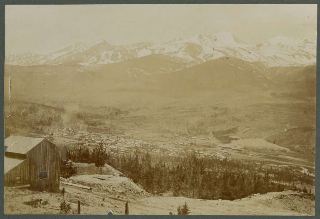
by Julia Anna Moore Hello friend, Welcome to the Wedgewood Lodge, slope-side, next to Snowflake Lift. Snowflake is a one-of-a-kind two-person lift that has a mid-load station and 70-degree turn to put you at Peak 8. It’s personally one of my favorite lifts of all time especially when snow is quietly falling, blanketing the landscape in Colorado’s legendary white powder. We’re extremely stoked that you have chosen Breckenridge, and even more so that you’re staying with us. We pride ourselves in being a long-standing boutique experience, with studio spaces to three bedroom townhomes. We’re still family-owned and operated and specialize in group travel and weddings. Whether you’re here for the ski season or a summer getaway, we are only a few blocks from Main Street and just a stones throw from the slopes where you can ride and hike. We renovated in 2023–2024 and within that renovation we decided to customize each and every space with unique historic photographs curated by me (Jules)! The artwork in your unit is unique to you and contains a piece of Breck’s history. In addition, you’ll see some of my own photographs sprinkled throughout the space. Each unit is also named after a run somewhere in Breck’s 3,000+ acres, with the story behind it explained below. Unfortunately, we only have 52 units, so a lot of runs were left unmentioned but we hope that you get to explore as much as you can. At Wedgewood, we love where we live and want to display how far the town has come. Thanks for coming, and enjoy your stay. How to get to Quandary. Quandary is a short black diamond below Snow White and Lake Chutes. It’s only accessible by dropping in from above or taking 6-Chair and traversing across. I recommend only advanced skies attempt any runs on 6-Chair because all the trails have variable terrain and a lot of bumps. Quandary Peak. This peak was named in the 1860s when a group of prospectors discovered a metal on the mountain that they were unable to actually identify. They found themselves in a quandary, or a state of perplexity. It’s now one of the most climbed 14ers in Colorado, and is the highest summit of the Tenmile Range in Colorado, standing at 14,271 feet. It offers a relatively easy ascent via the East Ridge trail (Class 1), making it popular among hikers and backcountry skiers. If you decide to climb Quandary, please go early and go prepared. Summiting a 14er is not to be taken lightly. Mountain Range, from Hoosier Pass, Colo: View east from Hoosier Pass in Summit County, Colorado; shows felled timber, tree stumps, and Mosquito Range mountains including Mount Bross, Mount Lincoln, North Star Mountain, and Quandary Peak. Original creator: [1910–1930?]; Haines Photo Co. (Conneaut, Ohio). Denver Public Library Special Collections, Z-1033. From top to bottom: View of Quandary Peak and the Tenmile Range, southwest of Breckenridge: View looking southwest from Boreas Pass, above Breckenridge, Colorado. Pictured far left is Quandary Peak, the highest summit in the Tenmile Range. Original creator: Unknown; Westerman, Otto. Summit Historical Society Collection. Image created by Breckenridge History, Colorado. Headwaters of McCullough Gulch: Newspaper clipping. Original creator: 1994; M. John Fayhee. Summit Daily. View looking southwest over the town of Breckenridge: Southwest view overlooking toward the town of Breckenridge. Snow-covered peaks of the Tenmile Range (including Mt. Quandary, Mt. Helen, Peak 10 and Peak 9) in the background. In the foreground is a wood structure. Handwritten on the reverse is “Breckenridge Colo.” Original creator: 1890s (Creation); Unidentified. Agnes Miner Collection; Gift, Colorado Springs Ghost Town Club. Breckenridge History, Colorado.
George’s Thumb, Breckenridge (527 at Wedgewood Lodge)
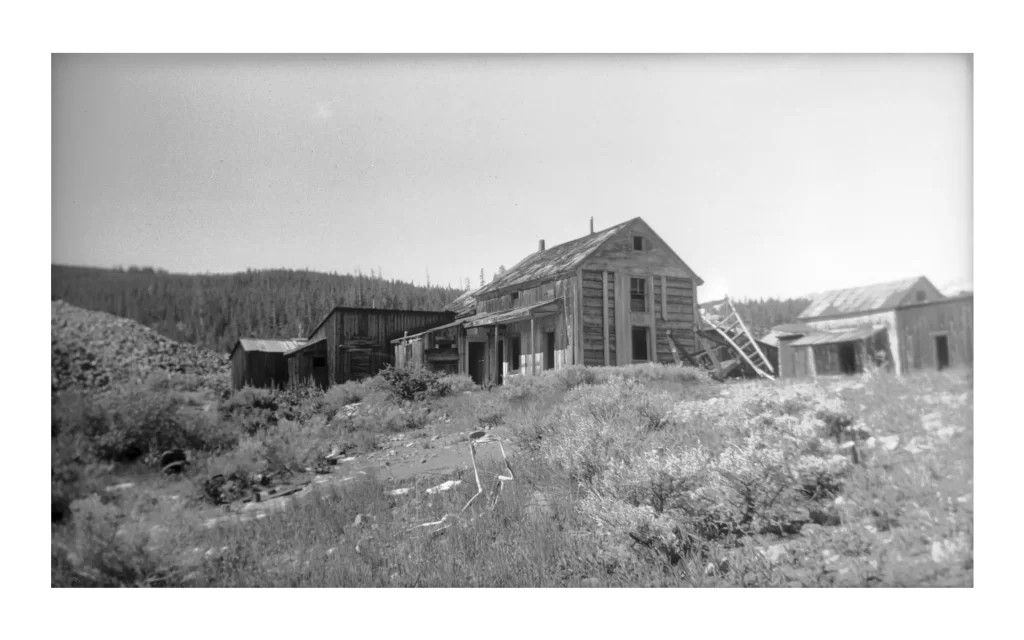
by Julia Anna Moore Hello friend, Welcome to the Wedgewood Lodge, slope-side, next to Snowflake Lift. Snowflake is a one-of-a-kind two-person lift that has a mid-load station and 70-degree turn to put you at Peak 8. It’s personally one of my favorite lifts of all time especially when snow is quietly falling, blanketing the landscape in Colorado’s legendary white powder. We’re extremely stoked that you have chosen Breckenridge, and even more so that you’re staying with us. We pride ourselves in being a long-standing boutique experience, with studio spaces to three bedroom townhomes. We’re still family-owned and operated and specialize in group travel and weddings. Whether you’re here for the ski season or a summer getaway, we are only a few blocks from Main Street and just a stones throw from the slopes where you can ride and hike. We renovated in 2023–2024 and within that renovation we decided to customize each and every space with unique historic photographs curated by me (Jules)! The artwork in your unit is unique to you and contains a piece of Breck’s history. In addition, you’ll see some of my own photographs sprinkled throughout the space. Each unit is also named after a run somewhere in Breck’s 3,000+ acres, with the story behind it explained below. Unfortunately, we only have 52 units, so a lot of runs were left unmentioned but we hope that you get to explore as much as you can. At Wedgewood, we love where we live and want to display how far the town has come. Thanks for coming, and enjoy your stay. How to get to George’s Thumb. George’s Thumb is a double black diamond run on Peak 8. There are many rocks through the middle of this run so either enter at the top and go far left or go down Imperial Ridge and enter below the rocks. It’s a fun open space to do big turns and is recommended only for advanced riders. This run is named after George Gruber, a retired ski patroller. In the 1980s, George was assigned to accompany a photographic crew taking publicity photos of the ski area. During a shoot, only George’s thumb appeared in a photo intended for ads. Despite this, the ski area used the photo on the front of the next year’s trail map, and the ski patrol named the area George’s Thumb. This story comes directly from George and his wife, Melissa, with thanks to Mike McCord, and the original story can be found on the Summit Daily. A sneaky businessman. In the 1870s and 1880s, while silver mining was predominant in Breckenridge, prospectors continued searching for lode-gold deposits, particularly in French Gulch, north of Breckenridge. Unlike rounded grains, the placer gold here appeared as sharp-edged wires and leaves, hinting at a nearby lode deposit. In 1879, prospector Harry Farncomb discovered a rich eluvial gold deposit in French Gulch, the source of the placer gold. To avoid a gold rush, Farncomb kept his find secret, quietly staked a claim named Wire Patch Placer, and slowly acquired adjacent land. A year later, he deposited 300 troy ounces of gold in a Denver bank, prompting a rush to French Gulch, only for miners to find Farncomb already owned the richest ground. This unit focuses on French Gulch, which can be still explored today. Mount Gyot at the head of French gulch: View of Mount Guyot at the head of French Gulch, southeast of Breckenridge, Colorado. Title quoted from handwritten caption on card mount: “Mount Gyot [sic] at the head of French gulch.” Original creator: circa 1880s-1903 (Creation); Westerman, Otto. J. Frank Willis Photograph Album. Breckenridge History, Colorado. French Gulch: Dilapidated buildings occupy an area in French Gulch, near Breckenridge (Summit County), Colorado. Original creator: 1942; Wolle, Muriel Sibell, 1898–1977. Denver Public Library Special Collections, X-3182. French Gulch dredge dumps: Piles of dredged up material sit in French Gulch, near Breckenridge (Summit County), Colorado. Original creator: 1942; Wolle, Muriel Sibell, 1898–1977. Denver Public Library Special Collections, X-3185. Wagons haul ore from Wellington Mine and Mill operations in French Gulch, east of Breckenridge: The separating and concentrating mill at the Wellington Mine on the north side of French Gulch, east of Breckenridge, Colorado. Circa 1911. Several two-horse team wagons haul processed ore from the mill. In the foreground piles of lumber and round logs are stacked along the dirt wagon road. Original creator: Circa 1911; Unidentified. Summit Historical Society Collection. Image created by Breckenridge History, Colorado. Men outside the Blue Hill Mining Company’s boardinghouse at the Minnie Mine, east of Breckenridge: Men stand outside the Minnie Mine and Mill boardinghouse on Mineral Hill in French Gulch, east of Breckenridge, Colorado. The one-and-half story log building featured a shingled, side gable roof and exterior wooden stairs. A wooden boardwalk fronts the building. The Minnie Mine and Mill was owned by the Blue Hill Mining Company from 1890–1904. Original creator: Unknown; Unidentified. Summit Historical Society Collection. Image created by Breckenridge History, Colorado. Sawmill operations at the Extenuate (X10U8) Tunnel, east of Breckenridge: Piles of logs and finished mine timbers are stacked throughout the property. Original creator: Circa 1900s; Unidentified. Summit Historical Society Collection. Image created by Breckenridge History, Colorado.
Whiskey River, Breckenridge (529 at Wedgewood Lodge)
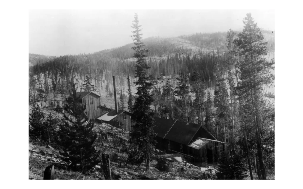
by Julia Anna Moore Hello friend, Welcome to the Wedgewood Lodge, slope-side, next to Snowflake Lift. Snowflake is a one-of-a-kind two-person lift that has a mid-load station and 70-degree turn to put you at Peak 8. It’s personally one of my favorite lifts of all time especially when snow is quietly falling, blanketing the landscape in Colorado’s legendary white powder. We’re extremely stoked that you have chosen Breckenridge, and even more so that you’re staying with us. We pride ourselves in being a long-standing boutique experience, with studio spaces to three bedroom townhomes. We’re still family-owned and operated and specialize in group travel and weddings. Whether you’re here for the ski season or a summer getaway, we are only a few blocks from Main Street and just a stones throw from the slopes where you can ride and hike. We renovated in 2023–2024 and within that renovation we decided to customize each and every space with unique historic photographs curated by me (Jules)! The artwork in your unit is unique to you and contains a piece of Breck’s history. In addition, you’ll see some of my own photographs sprinkled throughout the space. Each unit is also named after a run somewhere in Breck’s 3,000+ acres, with the story behind it explained below. Unfortunately, we only have 52 units, so a lot of runs were left unmentioned but we hope that you get to explore as much as you can. At Wedgewood, we love where we live and want to display how far the town has come. Thanks for coming, and enjoy your stay. How to get to Whiskey River. I’m unsure how Whiskey River was named, but it’s a cool one. This is an advanced run on Peak 7 that can lead you to The Dunes, Xanadu, or Delirium, which will take you to Peak 6 base. It’s a wide open space above the tree-line and it’s a fun way to travel across the five peaks of Breckenridge. Illinois Gulch. The Illinois Gulch District, considered part of the Breckenridge District by Vanderwilt (1947), initially saw hand-worked placer mining as described by Ransome (1911). Hydraulic mining later created a large pit in the area. Parker (1974) mentions a bedrock shaft started in 1898, but otherwise, only placer mining activities are noted. The Breckenridge Troll, located by the Stephen C. West Ice Arena parking lot, is the start of the trail that travels up Illinois Gulch. If you’re visiting in summer, it’s a beautiful area to explore on foot. Puzzle Mine in Illinois Gulch, southeast of Breckenridge: The Puzzle Mine workings in Illinois Gulch (Illinois Park), southeast of Breckenridge, Colorado. The small railroad trestle or bridge uphill from the mine was located between Hookeye Curve and the Gold Pan trestle. Original creator: 1920–1929 (Creation); Sayre, Robert H.. Robert H. Sayre Collection. Breckenridge History, Colorado. Railway snow shed in Illinois Park near Breckenridge: Narrow gauge railroad and snow shed over the tracks at Hook Eye Curve in Illinois Park near Breckenridge, Colorado. Original creator: circa 1880s-1903 (Creation); Westerman, Otto. J. Frank Willis Photograph Album. Breckenridge History, Colorado. Breckenridge: View of Breckenridge, Colorado, looking northeast shows frame or log dwellings and commercial buildings, including the Catholic Church, and the Gardner residence. Landmarks include Barney Ford Hill, Illinois Gulch, and the grade of the South Park Railroad. Original creator: 1881; Unidentified. Denver Public Library Special Collections, X-1948. Group portrait of men at the Ouray Mine site in Illinois Gulch near Breckenridge: Mine workers sit or stand by a log stockpile for a group portrait at the Ouray Mine site in Illinois Gulch, east of Breckenridge, Colorado. Behind them is a wood frame building or sawmill. Handwritten on the reverse: “Ouray Mine, Breckenridge.” Original creator: Undated (Creation); Unidentified. Agnes Miner Collection; Gift, Colorado Springs Ghost Town Club. Breckenridge History, Colorado. View of the railroad trestle and railway tracks on Barney Ford Hill in Illinois Park: View looking northwest towards the Tenmile Range with Illinois Gulch (Illinois Park) in the foreground. The Gold Pan trestle can be seen with the railway line curving around Barney Ford Hill. The Dunkin Mine is on the right. Southeast of Breckenridge, Colorado. Original creator: 1920–1929 (Creation); Sayre, Robert H. Robert H. Sayre Collection. Breckenridge History, Colorado. Washington Mine [stamp mill]: View of the Washington Mine stamp mill in Illinois Gulch near Breckenridge (Summit County), Colorado. Original creator: [1904?]; Unidentified. Denver Public Library Special Collections, X-62410.
High Anxiety, Breckenridge (520 at Wedgewood Lodge)
Welcome to the Wedgewood Lodge, your cozy retreat nestled slope-side next to the iconic Snowflake Lift! Experience the thrill of Breckenridge, where each of our uniquely designed units tells a story of the town’s rich history. From stunning studio spaces to spacious three-bedroom townhomes, we cater to every traveler. Discover the legendary High Anxiety run on Peak 8, a hidden gem waiting to be explored. Whether you’re here for skiing or summer adventures, we invite you to immerse yourself in the beauty of Colorado’s mountains and create unforgettable memories with us. Enjoy your stay!
Crosscut, Breckenridge (522 at Wedgewood Lodge)
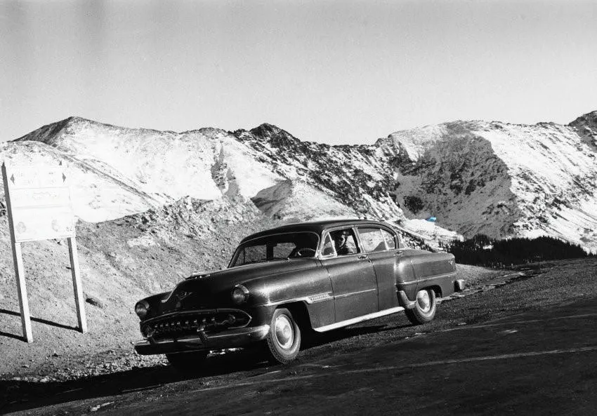
by Julia Anna Moore Hello friend, Welcome to the Wedgewood Lodge, slope-side, next to Snowflake Lift. Snowflake is a one-of-a-kind two-person lift that has a mid-load station and 70-degree turn to put you at Peak 8. It’s personally one of my favorite lifts of all time especially when snow is quietly falling, blanketing the landscape in Colorado’s legendary white powder. We’re extremely stoked that you have chosen Breckenridge, and even more so that you’re staying with us. We pride ourselves in being a long-standing boutique experience, with studio spaces to three bedroom townhomes. We’re still family-owned and operated and specialize in group travel and weddings. Whether you’re here for the ski season or a summer getaway, we are only a few blocks from Main Street and just a stones throw from the slopes where you can ride and hike. We renovated in 2023–2024 and within that renovation we decided to customize each and every space with unique historic photographs curated by me (Jules)! The artwork in your unit is unique to you and contains a piece of Breck’s history. In addition, you’ll see some of my own photographs sprinkled throughout the space. Each unit is also named after a run somewhere in Breck’s 3,000+ acres, with the story behind it explained below. Unfortunately, we only have 52 units, so a lot of runs were left unmentioned but we hope that you get to explore as much as you can. At Wedgewood, we love where we live and want to display how far the town has come. Thanks for coming, and enjoy your stay. How to get to Crosscut. Crosscut is a blue run underneath Snowflake lift (which is in our backyard) that is important to note. If you want to go to the mid-load station, you have to look for the trail in the woods that is on lookers-left. If you want to continue to Peak 9, you go straight and keep your speed because it’s pretty flat and difficult for most people. I don’t think Crosscut is named after anything specific, but is more of a functional name. Right after you pass C-Chair, there is another run named Snowflake that is on lookers-left, that will take you straight home to the base of Snowflake Chair. Loveland Pass. Loveland Pass is kind of like the crosscut for Summit County. Before there was the Eisenhower Tunnel, there was Loveland Pass. Loveland Pass and the city of Loveland are named after William A.H. Loveland, the president of the Colorado Central Railroad. In 1869, Loveland opened a wagon road connecting Denver with Leadville, which became part of the U.S. Highway system in 1919 and served as the main route from Denver to Georgetown until the Eisenhower Tunnel opened in 1973. Located along the Continental Divide, about 70 miles east of Denver, Loveland Pass reaches an elevation of 11,991 feet and has a gnarly 6.7% grade. It serves as an alternate route for trucks carrying hazardous materials and offers scenic mountain views. While it remains open year-round, the pass can be dangerous in winter and may close temporarily during snowstorms. Please check with Colorado Department of Transportation before heading out into difficult weather. Bus ride from Denver to Aspen, 1966: One b/w negative looking towards the summit of Loveland Pass (coming from the east side), 1966-. This was the route of I-70 at the time since Eisenhower Tunnel was not built until 1973. The photo was taken from inside of a bus that was transporting passengers from Denver to Aspen; they had become stranded in Denver when their flights were cancelled by inclement weather. Related images and a story are in the Aspen Illustrated News on January 5, 1967 (page 12). 35mm roll. Original creator: 1966; Hiser, Cherie Jenkins. Aspen Historical Society, Aspen Illustrated News Collection. Car On U.S. Highway 6 (Loveland Pass), 1954: One b/w photograph and negative of a car driving on U.S. Highway 6 (Loveland Pass). There is a sign on the side of the road indicating the direction and mileage to Denver and Dillion. Original creator: 1954; Ringquist, Loey. Aspen Historical Society, Ringquist Collection. Motoring on the Rockies: Clear creek, on the Loveland Pass road, near Silver Plume, only adds to the enjoyment of an auto tour. Original creator: June 7, 1925; The Rocky Mountain News. Colorado Historic Newspaper Collection. View the Colorful Loveland Pass One Of Colorado’s Finest Scenic Beauty Spots: View the Colorful Loveland Pass One Of Colorado’s Finest Scenic Beauty Spots. Original creator: December 10, 1938; The Denver Star. Colorado Historic Newspaper Collection. Snowboarders walk into the summit of Loveland Pass during the moonlight to back country ski at night January 3, 2007. Scores of skiers gather during the full moon for an experience that is unique to Colorado’s back country: Snowboarders are at the top of their game, having reached the summit of Loveland Pass. During the previous full moon Jan. 3, skiers could be found making tracks in new snow on or around Loveland Pass, Berthoud Pass, Quandary Peak and the Indian Peaks Wilderness Area. Original creator: 2007; DENNIS SCHROEDER. Donated to the Denver Public Library by the Rocky Mountain News, RMN-032–9070. William A. “Bill” Southworth at the Continental Divide, Loveland Pass, Colorado: Tenth Mountain Division soldier, William A. “Bill” Southworth poses for a portrait at the Continental Divide. He is wearing a khaki uniform with a white belt, which was not army issue. The signs at the side of the highway identify the place: the first is Colorado, U.S. Highway 6. Denver 62 miles east, Dillon 15 miles west. A larger sign reads Continental Divide, Loveland Pass, elevation 11,992 feet above sea-level; Atlantic Ocean watershead to the east, Pacific Ocean; watershead to the west; Clear Creek County to the east, Summit County to the west. Original creator: [1943,1944]; Southworth, William A., 1921–2003. 10th Mountain Division Resource Center, Denver Public Library.
Tom’s Baby, Breckenridge (515 at Wedgewood Lodge)
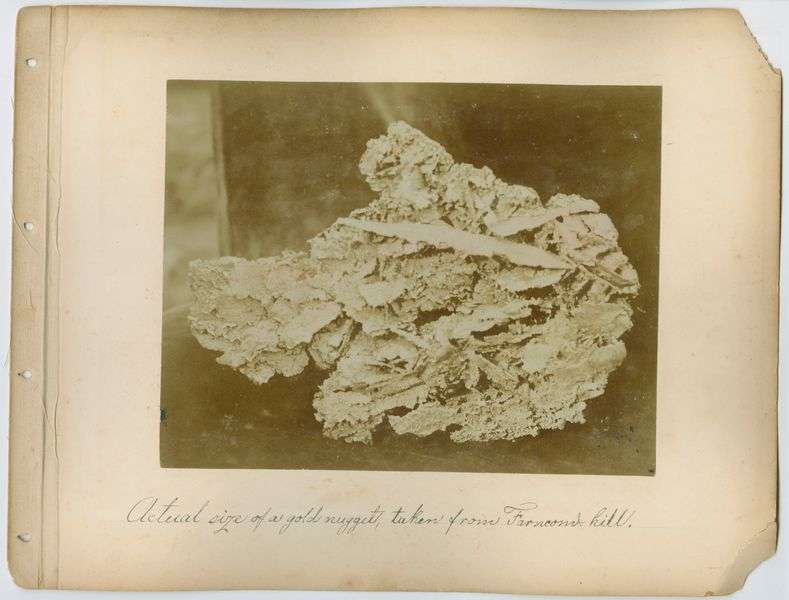
by Julia Anna Moore Hello friend, Welcome to the Wedgewood Lodge, slope-side, next to Snowflake Lift. Snowflake is a one-of-a-kind two-person lift that has a mid-load station and 70-degree turn to put you at Peak 8. It’s personally one of my favorite lifts of all time especially when snow is quietly falling, blanketing the landscape in Colorado’s legendary white powder. We’re extremely stoked that you have chosen Breckenridge, and even more so that you’re staying with us. We pride ourselves in being a long-standing boutique experience, with studio spaces to three bedroom townhomes. We’re still family-owned and operated and specialize in group travel and weddings. Whether you’re here for the ski season or a summer getaway, we are only a few blocks from Main Street and just a stones throw from the slopes where you can ride and hike. We renovated in 2023–2024 and within that renovation we decided to customize each and every space with unique historic photographs curated by me (Jules)! The artwork in your unit is unique to you and contains a piece of Breck’s history. In addition, you’ll see some of my own photographs sprinkled throughout the space. Each unit is also named after a run somewhere in Breck’s 3,000+ acres, with the story behind it explained below. Unfortunately, we only have 52 units, so a lot of runs were left unmentioned but we hope that you get to explore as much as you can. At Wedgewood, we love where we live and want to display how far the town has come. Thanks for coming, and enjoy your stay. How to get to Tom’s Baby. Tom’s Baby and Tom’s Mom are some of my favorite names of trails in Breck. This run has historical significance because it was named after the biggest gold nugget ever found in history, which I will talk about below. To honor this incredible find, this double black diamond on Peak 9 was named after… well… Tom’s Baby. I recommend that only advanced skiers go to this steep tree run which is accessed by Mercury SuperChair. Farncomb Hill and the big baby. On July 23, 1887, Tom Groves and Harry Lytton discovered the largest piece of gold ever found in Colorado, a 13 ½ pound nugget in the Farncomb Hill area near Breckenridge, famously known as “Tom’s Baby” after Groves wrapped it in a blanket and carried it like an infant to avoid theft. Groves paraded the massive gold nugget around Breckenridge, where it quickly became renowned. After being cleaned by an assayer, the nugget was handed to a mine owner, Ward, who sent it to Denver, where it mysteriously vanished. Around 1900, it was sought for exhibitions but remained missing until local historian Mark Fiester rediscovered it in 1972 in a Denver bank vault, mislabeled as dinosaur bones (are you kidding me?). The piece, now 10 ½ pounds, resides at the Denver Museum of Nature & Science, still stirring curiosity about the missing three pounds. Three pounds of gold today would be worth a little over $103,000 USD (as of July 2024). What do you think happened to this chunk? I guess we will never know. From top to bottom: View on Farncom hill: The Great Flume going around the hill opposite Mount Guyot (in background), northeast of Breckenridge, Colorado in autumn of 1895. In the snow, a man stands next to the waist-high wooden flume while a dog sits on top. Title quoted from handwritten caption on card mount: “View on Farncom [sic] hill.” Original creator: 1895 (Creation); Westerman, Otto. J. Frank Willis Photograph Album. Breckenridge History, Colorado. The mineral resources of Summit County: View of a 156 ounce specimen of crystallized gold, known as “Tom’s Baby,” taken from the Gold Flake Mine on Farncomb Hill, near Breckenridge, Summit County, Colorado. The specimen was named after Tom Groves, one of the miners who discovered it. Formerly F24822. Penciled on back of photographic print: “The largest gold nugget [sic] ever found in Colorado — (156 ounces or 13 lbs Troy). Taken from Gold Flake Mine on Farncomb Hill, Summit Co. July 23, 1887. Known as “Tom’s Baby” for Thomas F. Walsh, owner of mine [sic]. “ [In fact, the crystallized gold specimen was discovered by two miners, Tom Groves and Harry Lytton, and allegedly named after Tom Grove’s.]; Photographic print is of half-tone reproduction. Original creator: 1899; Jas. F. Callbreath Jr.. Denver Public Library Special Collections, X-60191. Great Flume in American Gulch on Farncomb Hill near Breckenridge: View of the Great Flume in American Gulch, located on Farncomb Hill near Breckenridge, Colorado. Circa 1896. The mill, originally built for the Victoria Gold Mining Company in 1887, is in view on the steep hillside. Original creator: Circa 1896; Unidentified. Summit Historical Society Collection. Image created by Breckenridge History, Colorado. Actual size of a gold nugget, taken from Farncomb hill: 136-ounce mass of crystalized gold from the Gold Flake vein on Farncomb Hill called “Tom’s Baby”. Found on July 23, 1887 by Harry Lytton and Tom Groves outside of Breckenridge, Colorado. Original creator: circa 1880s-1903 (Creation); Westerman, Otto. J. Frank Willis Photograph Album. Breckenridge History, Colorado. Wapiti Mining Company’s hydraulic operations in American Gulch near Breckenridge, Colorado: Wapiti Mining Company’s mining operations in American Gulch below Farncomb Hill, near Breckenridge, Colorado. An hydraulic pipe with high pressure nozzle (called a “Giant”) drives gravel from the tree-cleared hillside. The Victoria Gold Mining Company’s mill, built in 1888, is in view on the left. Original creator: Circa 1895; Westerman, Otto. Summit Historical Society Collection. Image created by Breckenridge History, Colorado. Ben Stanley Revett in a horse-drawn carriage coming down Farncomb Hill, Breckenridge: Ben Stanley Revett and another man in a two-horse drawn carriage coming down a steep dirt road on the French Gulch side of Farncomb Hill, near Breckenridge, Colorado. Mount Guyot in the background. Original creator: Circa early 1900s; Unidentified. Summit Historical Society Collection. Image created by Breckenridge History, Colorado.
Grits, Breckenridge (519 at Wedgewood Lodge)
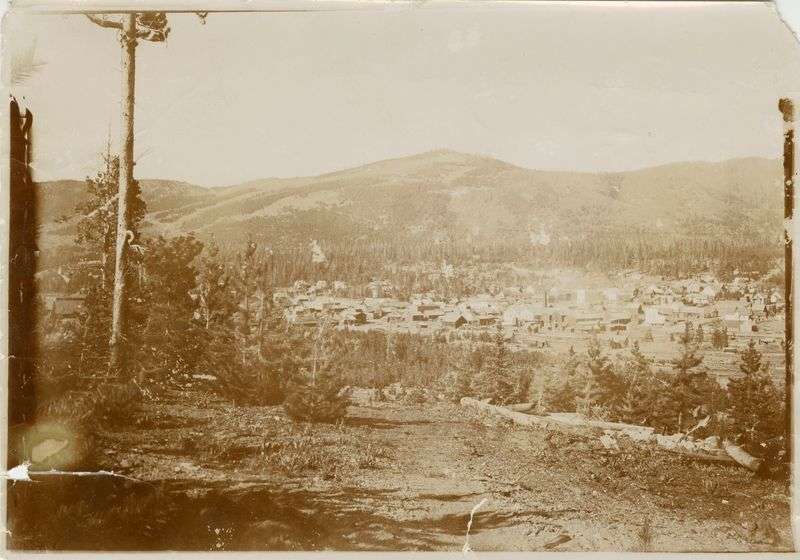
by Julia Anna Moore Hello friend, Welcome to the Wedgewood Lodge, slope-side, next to Snowflake Lift. Snowflake is a one-of-a-kind two-person lift that has a mid-load station and 70-degree turn to put you at Peak 8. It’s personally one of my favorite lifts of all time especially when snow is quietly falling, blanketing the landscape in Colorado’s legendary white powder. We’re extremely stoked that you have chosen Breckenridge, and even more so that you’re staying with us. We pride ourselves in being a long-standing boutique experience, with studio spaces to three bedroom townhomes. We’re still family-owned and operated and specialize in group travel and weddings. Whether you’re here for the ski season or a summer getaway, we are only a few blocks from Main Street and just a stones throw from the slopes where you can ride and hike. We renovated in 2023–2024 and within that renovation we decided to customize each and every space with unique historic photographs curated by me (Jules)! The artwork in your unit is unique to you and contains a piece of Breck’s history. In addition, you’ll see some of my own photographs sprinkled throughout the space. Each unit is also named after a run somewhere in Breck’s 3,000+ acres, with the story behind it explained below. Unfortunately, we only have 52 units, so a lot of runs were left unmentioned but we hope that you get to explore as much as you can. At Wedgewood, we love where we live and want to display how far the town has come. Thanks for coming, and enjoy your stay. How to get to Grits. Grits doesn’t have a specific connection to history but grits and flapjacks were common campfire foods for prospectors, and I just think the names are full of humor. This run is a black diamond in Peak 10 that juts out from Crystal. It’s a short tree run that lands on Upper Lehman and is worth a visit. I recommend only advanced riders attempt Peak 10. Gibson Hill. This area in Breck was home to Gold Run Placer over 100 years ago. Gibson Hill had valuable gold, like many of the mines in the area. A lot of the photographic evidence we have of this area is from the J. Frank Willis Collection, which makes sense because they owned property on Gibson Hill, but information is fragmented. You can read more about Breckenridge’s general mining history here. From top to bottom: View from the Willis property on Gibson hill, 1000 ft above town, showing Breckenridge in the distance: View of Breckenridge and the snow-covered peaks of the Tenmile Range looking southwest from Gibson Hill. The location of the Willis family property is indicated by a pink color tint on the building’s roof. Original creator: circa 1880s-1903 (Creation); Westerman, Otto. J. Frank Willis Photograph Album. Breckenridge History, Colorado. View of the Willis Property, as seen from Breckenridge: North end of Breckenridge, Colorado with the Willis property above on Gibson Hill. The property is indicated with a pink color tint. Original creator: circa 1880s-1903 (Creation); Westerman, Otto. J. Frank Willis Photograph Album. Breckenridge History, Colorado. View of Breckenridge with Gibson Hill in the background: View of Breckenridge, Colorado, looking northeast with Gibson Hill in the background. On the right is the 1882-built frame schoolhouse on Harris Street. Other false front and frame buildings are in view, including the Breckenridge Masonic Lodge on Washington Avenue and Main Street, and Barney Ford’s home on the opposite corner. A tall lodgepole tree stands in the left foreground. Original creator: Circa 1896–1900; Unidentified . Summit Historical Society Collection. Image created by Breckenridge History, Colorado. Hydraulic mining crew at Gold Run Placer on Gibson Hill near Breckenridge, Colorado: Hydraulic mining at Gold Run Placer on Gibson Hill, near Breckenridge, Colorado. Circa early 1900s. Men from the pit crew stand by while a “Giant” (a high pressure nozzle fitted on a hydraulic pipe) directs a powerful jet of water towards the base of a gravel bank. Original creator: Circa early 1900s; Unidentified . Summit Historical Society Collection. Image created by Breckenridge History, Colorado. Breckenridge, Colo, from Gibson Hill: View of Breckenridge, Colorado, looking southwest shows dwellings and commercial buildings of the town. Landmarks include two churches, false fronted structures and, in the foothills, numerous mining facilities. A frame, gable roofed structure is in the left in the foreground, and in the background, snow covers the peaks of the Ten Mile Range. Original creator: [1890–1899?]; Westerman, Otto. Denver Public Library Special Collections, X-1951. J. Frank Willis with his bicycle outside his house on Gibson Hill, east of Breckenridge: J. Frank Willis’ one and half story front gable frame house on Gibson Hill, east of Breckenridge, Colorado. Outside, Willis holds his bicycle by the handle as he props his left foot on the bike pedal. A second bike leans against a tree by a dirt path. He wears a cap, coat, and knickers with stockings. Original creator: Circa 1880s-1903; Unidentified . Summit Historical Society Collection. Image created by Breckenridge History, Colorado.
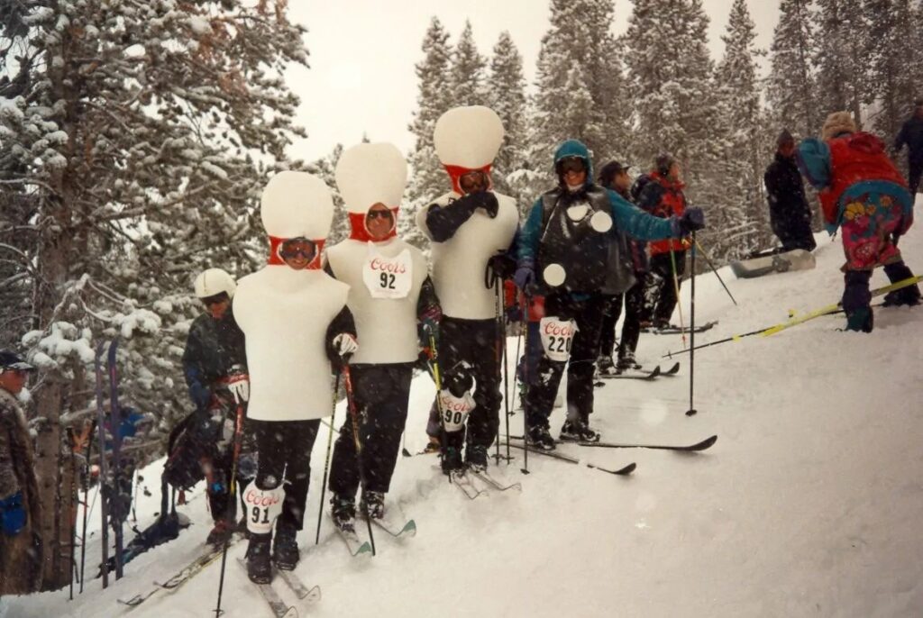
Snowbirds, Breckenridge (517 at Wedgewood Lodge)
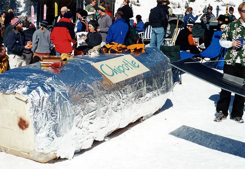
by Julia Anna Moore Hello friend, Welcome to the Wedgewood Lodge, slope-side, next to Snowflake Lift. Snowflake is a one-of-a-kind two-person lift that has a mid-load station and 70-degree turn to put you at Peak 8. It’s personally one of my favorite lifts of all time especially when snow is quietly falling, blanketing the landscape in Colorado’s legendary white powder. We’re extremely stoked that you have chosen Breckenridge, and even more so that you’re staying with us. We pride ourselves in being a long-standing boutique experience, with studio spaces to three bedroom townhomes. We’re still family-owned and operated and specialize in group travel and weddings. Whether you’re here for the ski season or a summer getaway, we are only a few blocks from Main Street and just a stones throw from the slopes where you can ride and hike. We renovated in 2023–2024 and within that renovation we decided to customize each and every space with unique historic photographs curated by me (Jules)! The artwork in your unit is unique to you and contains a piece of Breck’s history. In addition, you’ll see some of my own photographs sprinkled throughout the space. Each unit is also named after a run somewhere in Breck’s 3,000+ acres, with the story behind it explained below. Unfortunately, we only have 52 units, so a lot of runs were left unmentioned but we hope that you get to explore as much as you can. At Wedgewood, we love where we live and want to display how far the town has come. Thanks for coming, and enjoy your stay. How to get to Snowbirds. This run is a black diamond below Lake Chutes on Peak 8. It’s a great trail to lap on 6-Chair or finish your run from Imperial Bowl. It’s usually bumped out, as everything is in this area, and finishes out in Boneyards, which is the connector to 6-Chair. I love boneyard because of all the small trees, but be careful to not wreck your skis or board on the rocks sticking out. Cardboard Derby. This spring event was popular among resorts in the 90’s and early 2000’s, one being in Arapahoe Basin, the advanced mountain on Loveland Pass. Cardboard derbies have one rule: all sleds have to be made of only cardboard and tape to get sent down a hill with the creators inside. Some of these designs are absolutely insane and probably took hours of work to only be destroyed in seconds on the snow. Take a look at some of the most creative designs (in my opinion). From top to bottom: The Empire State Building: They also performed a skit, where a man dressed as a woman actually climbed to the top and screamed, Also note the plane stuck to the the side of the building. Original creator: 2000; A-Basin Ski Area — Knick Knack. A-Basin Ski Area — Knick Knack Smokey and the Bandit: Just like the old Burt Reynolds movie, there was the Bandit driving his Trans-Am, Smokey in the police cruiser, and a beer truck somewhere behind the both of them. Original creator: 2000; A-Basin Ski Area — Knick Knack. A-Basin Ski Area — Knick Knack. Grateful Sled 5: The fifth annual Grateful Sled. This time it was a VW Microbus, jacked up with some monster tires. On the way down the hill the tires came off and actually beat the bus down. Original creator: 2001; A-Basin Ski Area — Knick Knack. A-Basin Ski Area — Knick Knack. Trojan Horse Going: Well, it started out really spectacular. Original creator: 2001; A-Basin Ski Area — Knick Knack. A-Basin Ski Area — Knick Knack. Chipotle Burrito: Considering the drinking going on that day, I’m sure more than one person wished this was real. Original creator: 2001; A-Basin Ski Area — Knick Knack. A-Basin Ski Area — Knick Knack. A-Basin Scenery: I doubt you could find a nicer day or a better location for such madness. Original creator: 2001; A-Basin Ski Area — Knick Knack. A-Basin Ski Area — Knick Knack.
CJ’s Cabin, Breckenridge (516 at Wedgewood Lodge)
by Julia Anna Moore Hello friend, Welcome to the Wedgewood Lodge, slope-side, next to Snowflake Lift. Snowflake is a one-of-a-kind two-person lift that has a mid-load station and 70-degree turn to put you at Peak 8. It’s personally one of my favorite lifts of all time especially when snow is quietly falling, blanketing the landscape in Colorado’s legendary white powder. We’re extremely stoked that you have chosen Breckenridge, and even more so that you’re staying with us. We pride ourselves in being a long-standing boutique experience, with studio spaces to three bedroom townhomes. We’re still family-owned and operated and specialize in group travel and weddings. Whether you’re here for the ski season or a summer getaway, we are only a few blocks from Main Street and just a stones throw from the slopes where you can ride and hike. We renovated in 2023–2024 and within that renovation we decided to customize each and every space with unique historic photographs curated by me (Jules)! The artwork in your unit is unique to you and contains a piece of Breck’s history. In addition, you’ll see some of my own photographs sprinkled throughout the space. Each unit is also named after a run somewhere in Breck’s 3,000+ acres, with the story behind it explained below. Unfortunately, we only have 52 units, so a lot of runs were left unmentioned but we hope that you get to explore as much as you can. At Wedgewood, we love where we live and want to display how far the town has come. Thanks for coming, and enjoy your stay. How to get to CJ’s. CJ’s Cabin is a really fun glade area on Peak 9 for kids and adults alike who are feeling adventurous. It gets a lot of sun, so it can get a little melted, but you can do pretty big turns in between the trees. It’s a harder blue, only because there are trees, but is a good step up for those trying to learn tree skiing on a little more difficult terrain. I couldn’t find exactly how CJ’s was named but a long time local and Olympian CJ Muller helped with naming loads of runs in the earlier days of Breck, so I’m assuming that CJ’s was named after him. This tree run is best accessed by staying left on Upper Lehman and turning onto the catwalk before dropping the trees to the right. The trees start off tight, so take it easy until it opens up, and be on the lookout for the secret cabin. Ten Mile Range. The Ten Mile Range, recently protected as a National Monument by President Joe Biden, softly undulates along Breckenridge’s western horizon, marking the Upper Blue River Valley boundary. Iconic Peak 8 towers above Breckenridge, related to the Matterhorn in Switzerland or Mount Rainier in Washington state. Early explorers like Rufus Sage and prospectors during the Pikes Peak gold rush mapped the region, noting its significant yet mysterious terrain. Historic maps and accounts from the 19th and early 20th centuries highlight the peaks’ names and the area’s mining history. Despite few mining claims along its eastern face, the range largely retains its historic appearance, now preserved for its cultural, historical, and natural resources, including the training grounds of the 10th Mountain Division and its significance to Native American tribes. Ten Mile Peaks from Dillon: View of snow covered Tenmile Peaks with possibly the Snake River and Colorado & Southern railroad tracks, Dillon, Summit County, Colorado. Original creator: [1882–1890]; Jackson, William Henry, 1843–1942. Denver Public Library Special Collections, WHJ-536. The Washington mine, showing ten mile Range: The Washington Mine near Breckenridge, Colorado, with the Tenmile Range in the background. Original creator: circa 1880s-1903 (Creation); J. Frank Willis Photograph Album. Breckenridge History, Colorado. J. Frank Willis Photograph Album. Breckenridge History, Colorado Ten Mile Range from Rocky Point: View of snow covered river basin with Tenmile Range and mountains from Rocky Point, Summit County, Colorado. Original creator: [1882–1900?]; Jackson, William Henry, 1843–1942. Denver Public Library Special Collections, WHJ-538. Ten Mile Peaks. Blue River valley: View of shallow bed of Blue River with Tenmile Peaks and one-story log building, Summit County, Colorado. Original creator: [1882–1900?]; Jackson, William Henry, 1843–1942. Denver Public Library Special Collections, WHJ-534. View of Ten Mile Range from Ore Bucket Lodge, Breckenridge: View from Ore Bucket Lodge over Breckenridge residences, Summit County, Colorado, shows the Ten Mile Range in the distance under cloudy skies. Original creator: [1940–1966]; Wolle, Muriel Sibell, 1898–1977. Denver Public Library Special Collections, X-5552. Breckenridge, Colo: View of Breckenridge (Summit County), Colorado. Shows the schoolhouse, the belfry of the Fireman’s Hall, the Denver Hotel, and the Arlington House, a frame building with a curvelinear false front and a wide cornice. The Methodist Church and the Ware-Carpenter Concentrator sheds are on the rise to west; behind them are deforested land and the Ten Mile Range. Original creator: [1892–1895?]; Westerman, Otto. Denver Public Library Special Collections, Z-1866.